| Monessen, Pennsylvania | |||
|---|---|---|---|
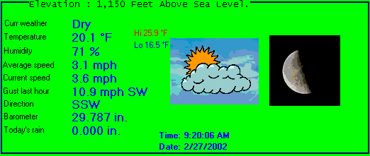
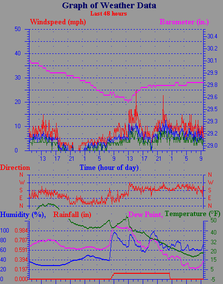
| LAST READING AT TIME: 09:20 DATE: February 27 2002 | |||
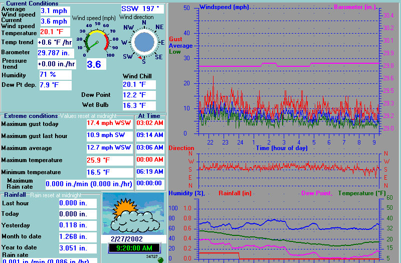
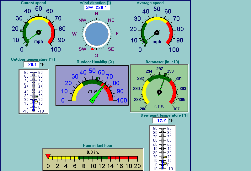
| Current Weather | Dry | Current Temperature | 20.1 °F |
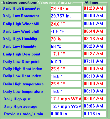
| Maximum Temperature (since midnight) | 25.9 °F at: 00:00 AM | Minimum Temperature (since midnight) | 16.5 °F at: 06:19 AM |
| Average windspeed (ten minute) | 5.9 mph | Wind Direction (ten minute) | SSW (200ş) |
| Windchill Temperature | 20.1 °F | Maximum Gust (last hour) | 12 mph at: 09:14 AM |
| Maximum Gust (since midnight) | 17 mph at: 03:02 AM | Maximum 1 minute average (since midnight) | 13 mph at: 03:06 AM |
| Rainfall (last hour) | 0.000 in | Rainfall (since midnight) | 0.000 in |
| Rainfall This month | 1.268 in | Rainfall To date this year | 3.051 in |
| Maximum rain per minute (last hour) | 0.000 in/min | Maximum rain per hour (last 6 hours) | 0.000 in/hour |
| Yesterdays rainfall | 0.118 in | DewPoint | 12.2 °F (Wet Bulb :16.3 °F ) |
| Humidity | 71 % | Barometer corrected to msl | 29.787 in |
| Pressure change | 0.00 in/ (last hour) | Trend | STEADY |
| Pressure change (last 12 hours) | +0.03 in | Pressure change (last 6 hours) | +0.03 in |


Use the RELOAD facility on your browser to retrieve the latest data.